STREAMLINED INFORMATION FROM AERIAL SYSTEMS Automate the processing and exploitation of drone data feeds for Public Safety
The LEAN process for drone data flow
If you’ve used Dropbox, you know how to use DigitalVista. Simply sync your folder of images and video, and when your processing is complete, you’ll receive an alert. The results are already syncing to your devices. It’s that simple.
Measuring debris pile volumes from drone collections
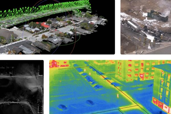
Upload your drone footage or still images and receive a geo-registered image on a web map that can be integrated into other applications. Get a 3D model that can be used to measure slopes, debris volume, water volume, water, vegetation, and road surface data layers for GIS.
Mission focused outputs from Digital Vista
Object recognition using state-of-the-art deep learning methods to find objects in your data feed. Save operator time with a report of identified objects like caved roofs, blue tarps, sinkholes, vehicles, and more. Create a viewshed layer that identifies vantage points for spotters or radio repeaters as well as hidden areas that are not easily observable. Publish your data on a private map layer, or open it to the world to receive assistance from the open mapping community.