
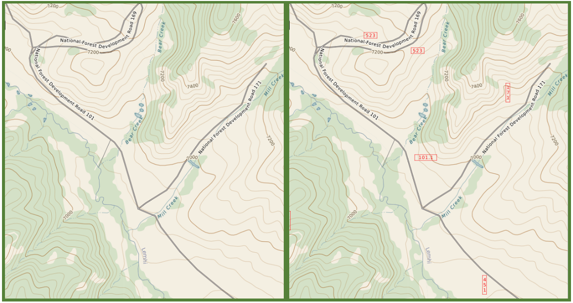
Azimuth1 and dbS Productions produce the FIND software for managing search and rescue missions. At a recent exercise in Idaho, we discovered that the forest service access roads in many regions are marked on the ground using number identifiers even when a road name exists. Remote forests in the US are often navigable only by a maze of numbered utility roads and our map’s users need more information to fill in these vast spaces. Open Street Map Data excels at providing excellent coverage in most places, but it falls a bit short on remote public land. So as an upgrade to the embedded TotalTopo map, we’ve added the USFS road identifiers to our maps in a similar style as the official USFS maps. These identifiers provide further details that will help inform backcountry users and SAR teams.
Moving forward, additional 4x4 tracks, hiking trails, and other various wilderness points of interest will be evaluated and added from the USDA Forest Service data. These details will further assist our users in the identification of search targets as part of SAR investigations and users of TotalTopo. This is a good example of how our team is continuously improving small details throughout the software by integrating and measuring user efficiency, training time, and feedback.